Nancy Edmonds Hanson
hansonnanc@gmail.com
Rare fall flooding has turned Moorheaders’ thoughts toward next spring. After experiencing eight of the region’s top 10 floods since 1997 – six of them in the 21st century, and the worst-ever just 10 years ago – the question is clear: What do this fall’s record rains and early October blizzard mean for the 2020 flood outlook?
“If I had a crystal ball, I’d be happy to tell you,” says city engineer Bob Zimmerman, who was on hand to fight all eight of them. Of course he doesn’t. He notes that several factors remain to be seen, including the ground saturation at freeze-up, the precipitation this winter, and the speed and timing of the spring thaw.
The first, saturated soil when the ground freezes, seems likely. The amount of precipitation? The National Weather Service gives 50-50 odds of higher-than-normal amount in the upper Great Plains, with the biggest chance in a bull’s eye that includes southern North Dakota, southern Minnesota and South Dakota plus the Great Lakes. Spring temperatures? The closest NWS will come for the region is an equal chance of colder or warmer.
But one thing, Bob says, is very clear: “There’s no question that fighting a flood that equals the magnitude of 2009 would be vastly different today. We’re in far, far better shape to handle the next one.”
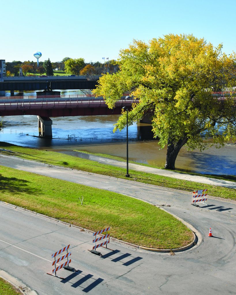
October’s swollen Red River has presented almost no problems in Moorhead. Its crest last week of 23 feet and the predicted high water mark 24 feet this Thursday is almost incidental, a foot under what’s considered minor flood stage. Third Street is closed under the bridges, and the city closed the flood gate and activated the pump station for the First Avenue North underpass. “For these levels, our infrastructure is pretty solid,” he noted. “We don’t get too geared up until it reaches moderate flood stage at 30 feet. Our new infrastructure really comes into play when the river gets to major flood stage at 35 feet. That’s where it would have affected homes along the river.”
But those homes are gone. As part of Moorhead’s $112.9 million flood mitigation efforts, some 268 homes that would fight the water at that level have been voluntarily sold by owners and removed by the city, with another 75 easements and partial acquisitions added to that total. More than 12 miles of levee now run through the yards where they once stood.
Seventy-eight stormwater gates prevent flood water from washing back into the sewers, along with 19 stormwater pump stations and five sanitary station upgrades. Five floodwalls with removable closures would be closed to hold back the Red at that level.
All in all, the floodwalls and levees protect the city to a level of 45 feet – well over the 40.84 recorded on March 28, 2009. The mammoth project was funded in part by the Minnesota Legislature through the Department of Natural Resources to the tune of $80.4 million. The city kicked in $32.2 million – $14.6 million as a required match plus another $17.6 million over-match. “The city council made a conscious decision back in 2012, after three big floods, to get it done as quickly as possible,” he recalls. “You’re much more able to acquire properties when people are willing to sell, and the memory of those floods did the trick.” The overmatch came out of that resolve. The state remembers that, Boadds: Since then, Moorhead hasn’t been asked to match the $7 million received in 2018 and 2019, recognizing it paid more than its share on the earlier projects.
But work remains. It’s already underway in the highest-priority unprotected area, part of the neighborhood added when the city annexed Oakport. Homes are being demolished along the river between Wall Street and 43rd Avenue North, where all affected properties have been acquired. Construction of levees is expected in 2020.
Another high-priority area along Riverview Circle on the south side remains in limbo. Sixteen of the necessary buy-outs are complete; until the 17th home is acquired, however, it is at a standstill.
So Bob’s prognostications for 2020 are mostly reassuring, especially when compared to where the city was in years gone by. Back in 2009, protecting it required 2.5 million sandbags. Now, he says, a flood of that magnitude would require no more than a few tens of thousands.
Yet the future is always uncertain. “There’s always a flood that could be bigger than the last one,” he muses. “We’ve done a really good job of addressing events of the magnitudes we’ve seen so far. But we’d never seen the like of them until 1997 and then 2009.
“That’s the whole thing behind the F-M Diversion project.” While aspects of the project remain caught up in the courts, he points out that progress can be seen. The main Red River inlet structure is under construction right now, with bids to be let in November for the Wild River River inlet. Even with no further legal delays, however, the earliest it could be complete is 2026.
Until January, the mysteries of 2020 flooding won’t begin to be predictable. He notes that city staff will pull out their flood plan after the first of the year, preparing to revise it for local conditions. At the same time, the Weather Service will issue its first probabilistic forecast.
“Until last January, we hadn’t had to use our plan for six years,” he says. “We learned some things and made some improvements. Going into winter with the ground saturated is not the best of news. But no matter what happens next, just remember that Moorhead’s infrastructure is far, far better than it was 10 years ago.”