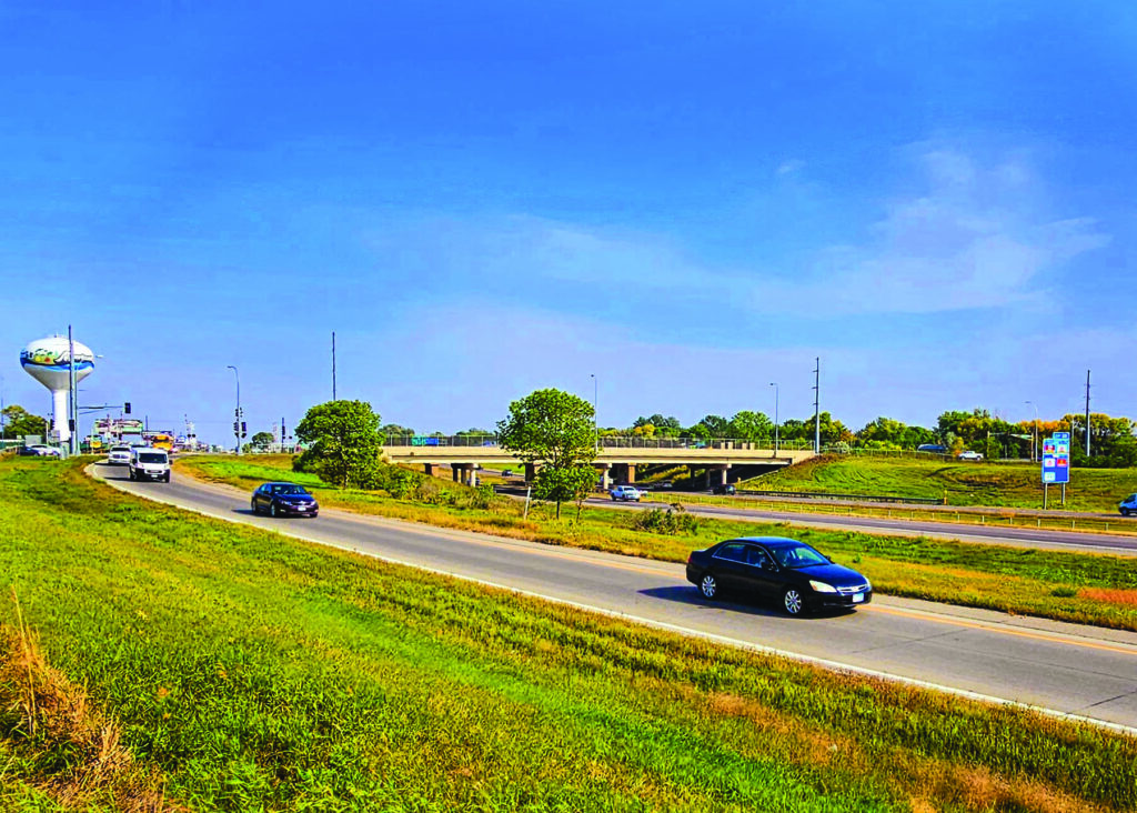
The 20th Street interchange with Interstate 94 includes only two alternatives — a westbound exit and eastbound extension. This view is in front of M State, which is in its northwest quadrant. (Photo/Nancy Hanson.)
Nancy Edmonds Hanson
Two of the four Moorhead exits along Interstate 94 look westward, and only westward. The Metropolitan Council of Governments is inviting the public to weigh in on whether that needs correcting.
At issue is the second interchange drivers encounter after crossing the Red River.
The first – the diverging diamond exit completed by the Minnesota Department of Transportation in 2016 – carries the most traffic north and south along Eighth Street South (Highway 75), a total of 28,000 vehicles a day.
The next two interchanges offer drivers only one option, either entering westbound I-94 or exiting the eastbound lanes onto 20th Street South or Southeast Main (Highway 52). The only other opportunity for entering from or exiting to the Minnesota side is the four-way interchange on 34th Street, about two and one-half miles east of the river.
Traffic counts for the two eastern interchanges are substantially less than the first east of the river. Traffic counts indicate 15,000 vehicles are using the 34th Street four-way installation each day, and just 7,000 use Highway 52. But the 20th Street interchange equals the total of both of them with a count of 20,000 cars and trucks.
MetroCOG transportation planner Dan Farnsworth is leading a project to examine the potential to reconstruct Exit 2 as a full four-way alternative. The organization oversees transportation policies for the F-M metro area, a role mandated by the federal government in 1973 as a condition for federal financial assistance. Its membership include representatives of Moorhead, Dilworth, Fargo, West Fargo, Horace, and Clay and Cass counties. Moorhead council member Chuck Hendrickson currently chairs the body.
Earlier this year, the group selected the Stantec group to conduct a study analyzing the need for a full interchange at 20th Street, as well as its feasibility. The national engineering consulting organization has been collecting information since June and coming up with a statement of need for the project. Their representatives joined Farnsworth and MetroCOG members Tuesday in the first of two public input meetings. Businesses potentially affected by a redesign and reconstruction – “stakeholders” – will have their chance to learn more and comment in November. With input from these initial meetings in hand, the agency and consultants plan to hold a second public meeting in January, when plans and options will be more fully put forth.
Expanding the interchange could be especially beneficial to some of its neighbors. M State lies in the northwest quadrant of the intersection; the limited access to the frontage road that runs immediately to the south has long frustrated drivers, who cannot directly enter there. The Moorhead Fire Department’s substation is on the north edge of the campus.
Triumph Lutheran Brethren Church occupies the southwest quadrant directly across I-94, with its parking lot entrance nestled close to the spot where entering cars turn onto 20th Street.
On the east side of the heavily traveled local street, classified as a “secondary arterial,” both public facilities and private businesses would be affected by the proposed reconstruction. Gavilon Fertilizer and Ken’s Sanitation and Recycling are located adjacent to the BNSF rail line that parallels 20th Street. Moorhead’s water tower is in the northeast area, too, along with a Moorhead Public Service substation. Acreage owned by Busch Agricultural Resources extends to the east and north.
South of the interstate, MnDOT itself operates the first wayside rest area within the state, along with a lift station. The largest stakeholder of all, the BNSF Railway, bisects the entire region as it parallels 20th Street. A multi-use trail also runs along the east side of the rails.
The Stantec study concentrates on both the primary area directly surrounding the interchange and how the interchange would affect the larger, secondary area. How would alternatives under consideration affect traffic on Eighth and 34th Streets, as well as adjacent businesses and homes along 30th Avenue South?
“There is no design to consider at this point. This is all preliminary,” Farnsworth emphasizes. “We’ll move on to considering alternatives, the cost-benefit ratio, and the estimated cost of the I-94 options.” It’s anticipated that the cost of the improvements would be largely covered by MnDOT, perhaps with some involvement from the city.
Only one thing is certain right now. He says, “The traffic counts throughout that area are going to go up.” He cites daily traffic on the Red River bridge. It saw 72,000 vehicles daily 10 years ago. Today that total is 82,000.
Residents are invited to share their thoughts on expanding the interchange by filling out a brief online survey. Go to https://fmmetrocog.org/20thInterchange/take-survey to share your comments.