
clay county histories
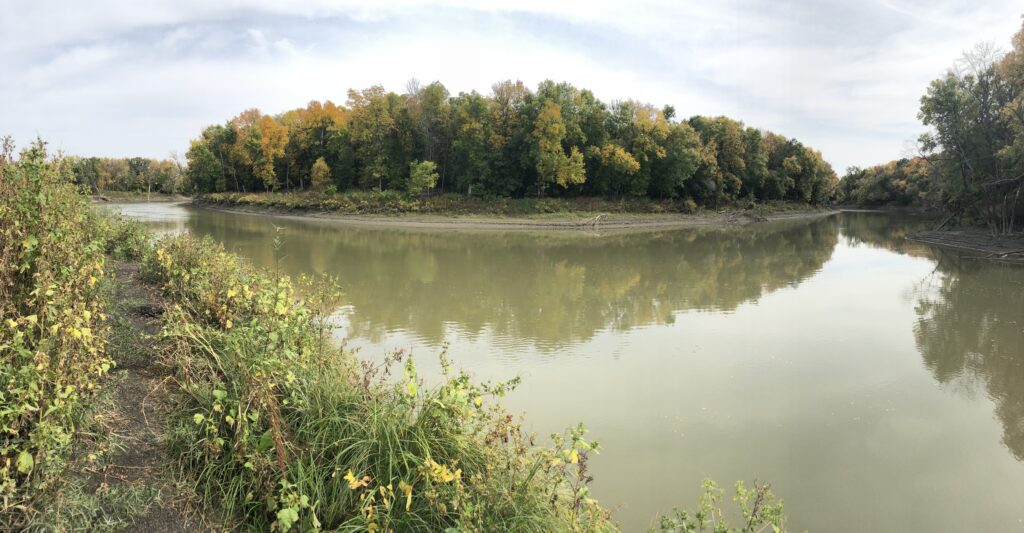
Looking at Minnesota from the confluence of the Wild Rice River and Red River, near 88th Avenue South, Fargo.
Markus Krueger | Program Director HCSCC
The Fargo-Moorhead Metro Area is many things, but being a regional transportation hub is at the heart of who we are. Outsiders might think of us as a city in the middle of nowhere, but our region’s residents know we are the intersection at the center of everywhere. People and goods traveling through the Northern Plains tend to flow through here. We are the destination for some, for others we are just where the road takes them on the way to where they’re going.
In September of 1871, almost 150 years ago, the Northern Pacific Railway announced where they would cross the Red River. This bridge created settlements they named Moorhead and Fargo, but the transcontinental railroad did not make this place a regional transportation hub. The railroad came here because it already was one. In fact, when they announced the crossing site, there were already about 500 people camped at Probstfield Farm waiting to be Moorhead residents. They knew it would cross somewhere at this natural intersection. Their guess was off by just 3 miles.
For most of human history and across cultures, rivers have been our roads. Rivers let us travel great distances with heavy cargo by boat. Even if we are on foot or on a horse, the tree-lined riverbanks are navigational beacons that guide us through oceans of prairie grass or thick forests. Follow a river and you won’t get lost. Ever since Lake Agassiz drained some 8,000-or-so years ago, the Red River has been an important north-south highway for people, fish, birds, and other animals. And a little north and south of where I’m sitting, major regional rivers flow into the north-south road from the east and west. The Fargo-Moorhead Metro Area is smack-dab in the middle of where the Buffalo River enters the Red from the east, and the Sheyenne River and Wild Rice River flow in from the west. For thousands of years, these rivers were I-94 and I-29 for the people of this region.
When the railroad arrived in 1871, the framework of our region’s modern road system was already here in the form of the Red River Trails. Established by the indigenous Métis people for traveling with their wooden Red River Carts, the Red River Trails connected our region to Native American trade networks in every direction as well as to Atlantic World trade networks leading eventually to Europe, South America, Africa, and beyond. We still drive on the Red River Trails, though they are paved now and may have moved a little this way or that. Now we call them highways, interstates, Oakport Road, etc.
Modern Londoners know their metropolis was once the ancient Roman city of Londinium, but here we too often rob ourselves of our land’s deep and long history. This essential part of what our community does – being the confluence of roads from every direction – didn’t start in 1871. Thousands of years before Stonehenge was raised and the first Pharaoh ruled Egypt, the rivers brought people to this place at middle of everywhere.